
Introduction of Primary Navigational Equipment
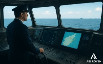
Primary Navigational Equipment ~ Navigation is the backbone of maritime operations. From ancient times when sailors relied on stars and compasses to today’s advanced satellite-based systems, navigational equipment has continuously evolved to enhance safety and efficiency. Every ship, regardless of size or function, must be equipped with essential navigational tools that help the crew determine the vessel’s position, direction, and safe route.
In this article, we will discuss the primary navigational equipment used in modern ships, their importance, and how they contribute to safe marine navigation.
What is Navigational Equipment?
Navigational equipment refers to instruments, tools, and systems that assist ship operators in determining their vessel’s position, planning a route, and avoiding hazards. These devices provide vital data such as speed, depth, location, and direction, enabling mariners to make informed decisions.
According to the International Maritime Organization (IMO) and SOLAS (Safety of Life at Sea) regulations, ships are required to carry specific navigational instruments to comply with international safety standards.
The Importance of Primary Navigational Equipment
The sea is unpredictable, with challenges such as poor visibility, rough weather, and hidden underwater hazards. Without reliable navigational tools, ships face a higher risk of accidents like collisions, groundings, or getting lost at sea.
Primary navigational equipment plays several roles, including:
- Accurate Positioning: Helps determine the ship’s location in real time.
- Route Planning: Assists in charting safe courses to avoid obstacles.
- Collision Avoidance: Detects nearby vessels and navigational hazards.
- Compliance: Meets international maritime safety requirements.
Primary Navigational Equipment Used in Ships
Below are the key navigational instruments that every vessel must carry:
1. Primary Navigational Equipment: Magnetic Compass
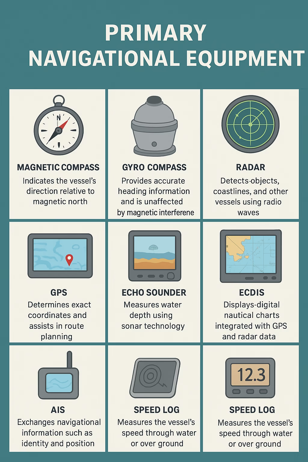
The magnetic compass is one of the oldest yet most reliable navigation tools. It works by aligning with the Earth’s magnetic field, indicating the vessel’s direction relative to magnetic north.
- Advantages: Simple, does not require power supply, and serves as a backup to modern electronic systems.
- Limitations: Can be affected by nearby magnetic fields or metallic structures.
Despite technological advancements, the magnetic compass remains mandatory on all ships.
2. Gyro Compass
Unlike the magnetic compass, the gyro compass uses the principles of a fast-spinning gyroscope and Earth’s rotation to find true north.
- Advantages: Unaffected by magnetic interference, provides accurate heading information, and can be integrated with autopilot systems.
- Use Case: Essential for large vessels and long voyages where precise navigation is critical.
3. Radar (Radio Detection and Ranging)
Radar is one of the most crucial navigation tools in modern shipping. It detects objects, coastlines, and other vessels by using radio waves.
- Functions: Collision avoidance, navigation in poor visibility (fog, night, or storms), and monitoring traffic in congested waters.
- Modern Features: ARPA (Automatic Radar Plotting Aid) integrates with radar to calculate the course, speed, and risk of collision of detected objects.
4. Global Positioning System (GPS)
GPS has revolutionized navigation by providing real-time positioning with exceptional accuracy. It works by receiving signals from satellites orbiting the Earth.
- Functions: Determines exact coordinates, calculates speed, and assists in route planning.
- Integration: Often linked with Electronic Chart Display and Information Systems (ECDIS) for advanced navigation.
5. Primary Navigational Equipment: Echo Sounder
The echo sounder measures the depth of water beneath the vessel using sonar technology.
- Functions: Prevents groundings, assists in anchoring, and provides seabed information.
- Working Principle: Emits sound waves that bounce off the seabed and return to the device, calculating depth based on time.
6. Electronic Chart Display and Information System (ECDIS)
ECDIS is an advanced navigation system that displays digital nautical charts integrated with GPS and radar data.
- Advantages: Automatic route planning, real-time monitoring, and compliance with IMO regulations.
- Safety Role: Reduces human error by providing alerts for shallow waters, restricted zones, and potential collision courses.
7. Automatic Identification System (AIS)
AIS is a communication-based system that allows ships to exchange navigational information such as identity, position, course, and speed.
- Functions: Enhances situational awareness, reduces collision risk, and helps vessel traffic services (VTS) monitor ship movements.
- Requirement: Mandatory for ships over 300 gross tons engaged in international voyages.
8. Primary Navigational Equipment: Speed Log
The speed log measures the vessel’s speed through water or over ground.
- Importance: Helps in navigation calculations, fuel management, and estimating the ship’s arrival time.
9. Primary Navigational Equipment: Auto Pilot
Autopilot systems maintain a vessel’s course automatically based on input from the gyro compass or GPS.
- Benefits: Reduces crew fatigue, improves accuracy, and enhances fuel efficiency.
Supporting Navigational Instruments
In addition to the primary tools mentioned above, ships often use supporting instruments such as:
- Barometer and Weather Instruments for monitoring atmospheric pressure and forecasting weather changes.
- Binoculars for visual observation of landmarks and other vessels.
- Navtex Receiver for receiving navigational and meteorological warnings.
Future of Navigational Equipment
Maritime technology is evolving rapidly with the integration of Artificial Intelligence (AI), Augmented Reality (AR), and advanced satellite systems. Future navigational equipment will likely focus on:
- Smart Route Optimization for fuel efficiency.
- Autonomous Navigation in unmanned ships.
- Real-Time Global Monitoring for enhanced safety and sustainability.
These advancements will further reduce risks and improve operational efficiency across the maritime industry.
Conclusion of Primary Navigational Equipment
Primary navigational equipment forms the foundation of safe and efficient maritime operations. From the traditional magnetic compass to advanced systems like ECDIS and AIS, these instruments ensure that vessels navigate safely across oceans and avoid accidents.
For ship operators and maritime professionals, understanding the role and importance of each navigational tool is not only a regulatory requirement but also a critical aspect of ensuring the safety of life at sea.
By combining traditional methods with cutting-edge technology, modern ships are better equipped than ever to face the challenges of the open sea.